

Cartographic Integrity Non-Negotiable: MEA Reasserts UN Maps Must Depict J&K and Ladakh Strictly per Official Indian Boundaries
Following New Delhi’s vote in support of a UN General Assembly resolution to correct continental distortions, the Ministry of External Affairs unequivocally warns that multilateral cartographic exercises cannot distort sovereign territorial demarcations.
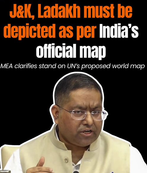
NEW DELHI: In an unambiguous foreign policy assertion, the Ministry of External Affairs (MEA) declared that any proposed United Nations-backed world mapping project must depict the entire Union Territories of Jammu & Kashmir and Ladakh in complete conformity with India’s official maps. Drawing a firm red line against cartographic dilution, New Delhi emphasized that its sovereignty and territorial integrity are absolute, consistent, and strictly non-negotiable, warning that any misleading or inaccurate depiction on global platforms remains completely unacceptable.
Key Takeaways from the MEA Pronouncement
- Sovereign Demarcation: The entirety of Jammu & Kashmir and Ladakh must be displayed strictly as delineated by the Survey of India, without arbitrary dotted lines or provisional status disclaimers.
- Vote Contextualized: India voted in favour of the UNGA resolution titled “Correct the Map” solely to support the technical principle of equal-area landmass representation.
- No Political Authentication: MEA clarified that the non-binding resolution does not authenticate any specific global boundary map, projection model, or territorial nomenclature.
- Zero Tolerance: Any effort by international agencies or digital publishers to misrepresent Indian boundaries will meet legal and diplomatic consequences.
Backing Proportional Landmasses, Not Political Revisions
The clarification followed the adoption of a United Nations General Assembly (UNGA) draft resolution spearheaded by Togo and supported by the African Group. The resolution, titled “Correct the Map: Rebalancing Global Cartographic Representation and Promoting Equitable Representation of the World’s Regions, Particularly Africa,” secured 164 votes in favour, with six abstentions and a sole dissenting vote from the United States.
The diplomatic measure encourages governments, educational curricula, and media institutions to transition away from the 16th-century Mercator projection—which inflates high-latitude landmasses like Europe and North America while shrinking equatorial continents such as Africa—towards equal-area models like the Equal Earth projection.
Anticipating deliberate misinterpretations or cartographic overreach by international bureaucracies, MEA Official Spokesperson Randhir Jaiswal delivered an emphatic clarification to prevent conflation between geographical scaling and political sovereignty:
“India’s sovereign territory, including the Union Territories of Jammu and Kashmir and Ladakh, must be depicted in accordance with India’s official map. Any inaccurate or misleading depiction is unacceptable. Our position on India’s sovereignty and territorial integrity is clear, consistent, and non-negotiable.” — Randhir Jaiswal, Official Spokesperson, Ministry of External Affairs
| Cartographic Dimension | UN Resolution Objective | Government of India’s Red Line |
|---|---|---|
| Core Scope | Equal-area continental representation to counter Mercator distortions. | Technical equal-area models accepted; boundary alterations rejected. |
| J&K and Ladakh | Historically shown with dotted lines or status notes in UN Secretariat cartography. | Entire geographical territory belongs to India; any deviation deemed void. |
| Legal Status of Text | Non-binding resolution encouraging educational and digital shifts. | Does not establish political cartography or validate disputed claims. |
| Domestic Mandate | Advisory framework across international bodies. | Strict compliance with Survey of India standards under statutory penalties. |
Methodological Neutrality at the UN
During the Explanation of Vote (EoV) at the General Assembly, First Secretary Raghoo Puri at the Permanent Mission of India to the UN stressed that New Delhi welcomed the overarching goal of eliminating visual distortions without endorsing one specific proprietary projection system. India underscored that the text should remain technologically and methodologically neutral, allowing individual member states to determine appropriate applications for their educational and planning needs.
Crucially, the MEA highlighted that the sponsor nations explicitly acknowledged that the initiative does not impinge on territorial delimitation, state borders, or political status.
Jammu Mirror Assessment: Safeguarding the Northern Frontiers
For audiences in Jammu, Kashmir, and Ladakh, the MEA’s prompt intervention carries substantial strategic weight. Over several decades, international cartographic bodies and multinational technology firms have periodically resorted to inaccurate disclaimers or arbitrary dashed borders regarding the Union Territories.
By establishing clear parameters immediately following the UNGA vote, New Delhi has signaled that domestic statutory mapping frameworks—backed by the Survey of India—must be respected across all global publications, digital atlas engines, and educational materials. The position remains categorical: administrative reformulations and international mapping adjustments cannot supersede India’s sovereign constitutional boundaries.