

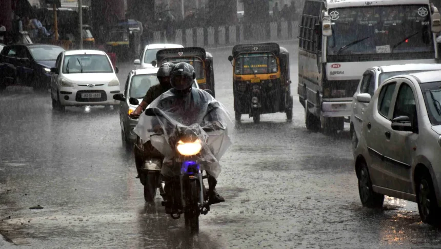

Rain Lashes Several Districts of J&K; MeT Predicts Extended Wet Spell, Issues Flash Flood Advisory for Vulnerable Belts
Katra and Kathua register intense precipitation; Srinagar records above-normal daytime temperatures even as weatherman forecasts cloudy skies and intermittent thundershowers.
SRINAGAR / JAMMU: Widespread spells of rain lashed multiple parts of Jammu and Kashmir on Tuesday, breaking dry spells in several districts. The Meteorological Centre Srinagar has forecast intermittent precipitation across the Kashmir Valley and Jammu division over the next 48 hours, cautioning that brief, intense downpours could trigger flash floods, mudslides, and landslides in vulnerable mountainous belts.
Precipitation was recorded across south, central, and north Kashmir—including Pahalgam, Shopian, Kulgam, Pulwama, Bandipora, and sections of Budgam and Kupwara—alongside widespread showers across the plains and hills of the Jammu division.
Precipitation Records: Kathua and Katra Top Charts
According to official data released by the Meteorological Centre, the Jammu region witnessed the heaviest share of rainfall during the past 24-hour cycle. Among conventional observatories, Katra emerged as the wettest station with 62 mm of rainfall, while the Automatic Weather Station (AWS) network registered a peak of 73 mm at Kathua.
| Station / Region | Rainfall Recorded (Past 24 Hours) |
|---|---|
| Kathua (AWS) | 73.0 mm |
| Katra (Main Station) | 62.0 mm |
| Kathua (Main Station) | 60.2 mm |
| Poonch | 38.5 mm |
| Udhampur | 27.0 mm |
| Reasi | 21.0 mm |
| Samba | 11.0 mm |
| Rajouri | 10.5 mm |
| Qazigund | 6.4 mm |
| Pulwama | 5.5 mm |
| Konibal | 3.0 mm |
| Ganderbal | 2.5 mm |
| Anantnag | 2.0 mm |
| Gulmarg | 1.0 mm |
| Srinagar / Doda / Kulgam | 0.3 mm – 0.5 mm |
| Pahalgam, Kupwara, Kokernag, Kishtwar, Bandipora (AWS) | Nil / Traces |
Temperature Patterns: Valley Sees Above-Normal Mercury
Despite the wet spells, summer temperatures in the Valley remained significantly higher than seasonal averages. Srinagar recorded a maximum temperature of 33.0°C—marking an anomaly of 4.1 degrees above normal—while its minimum hovered at 20.9°C, nearly 5 degrees higher than usual.
| Station | Max Temp (°C) | Min Temp (°C) |
|---|---|---|
| Srinagar (Main) | 33.0 | 20.9 |
| Jammu City (Main) | 33.9 | 25.2 |
| Kathua | 34.8 | 23.4 |
| Kupwara | 33.2 | 18.4 |
| Konibal | 33.2 | 19.4 |
| Pulwama (AWS) | 32.7 | 19.1 |
| Bandipora / Awantipora (AWS) | 32.4 | 19.6 – 20.1 |
| Qazigund | 31.2 | 18.6 |
| Kokernag | 31.4 | 18.2 |
| Bhaderwah | 30.0 | 18.2 |
| Banihal | 29.6 | 20.5 |
| Batote | 28.2 | 19.1 |
| Pahalgam | 27.6 | 17.5 |
| Sonamarg (AWS) | 25.1 | 14.9 |
| Gulmarg | 22.2 | 12.2 |
Extended Weather Outlook (September 2 – September 12)
Synoptic Weather Forecast
- September 2: Skies will remain generally overcast across the Union Territory, with one or two rounds of light to moderate rain or thundershowers expected across widespread areas. The Jammu division is likely to experience brief, intense to heavy showers during the early morning and late afternoon/evening hours.
- September 3: Predominantly dry conditions will prevail, punctuated by isolated, brief showers.
- September 4: Light to moderate rain accompanied by thundershowers and localized intense bursts is expected across many places.
- September 5 to 12: Weather is likely to remain mostly dry across Jammu & Kashmir, though short spells of isolated showers cannot be ruled out during early morning and afternoon hours.
Safety Advisory & Guidance for Farmers
The Meteorological Centre has advised the general public and tourists to exercise vigilance near hilly slopes, rivulets, and low-lying zones prone to surface runoff and mudslides. Meanwhile, the department clarified that agricultural and horticultural harvesting activities may proceed as planned with routine precautions.